Round Island Route
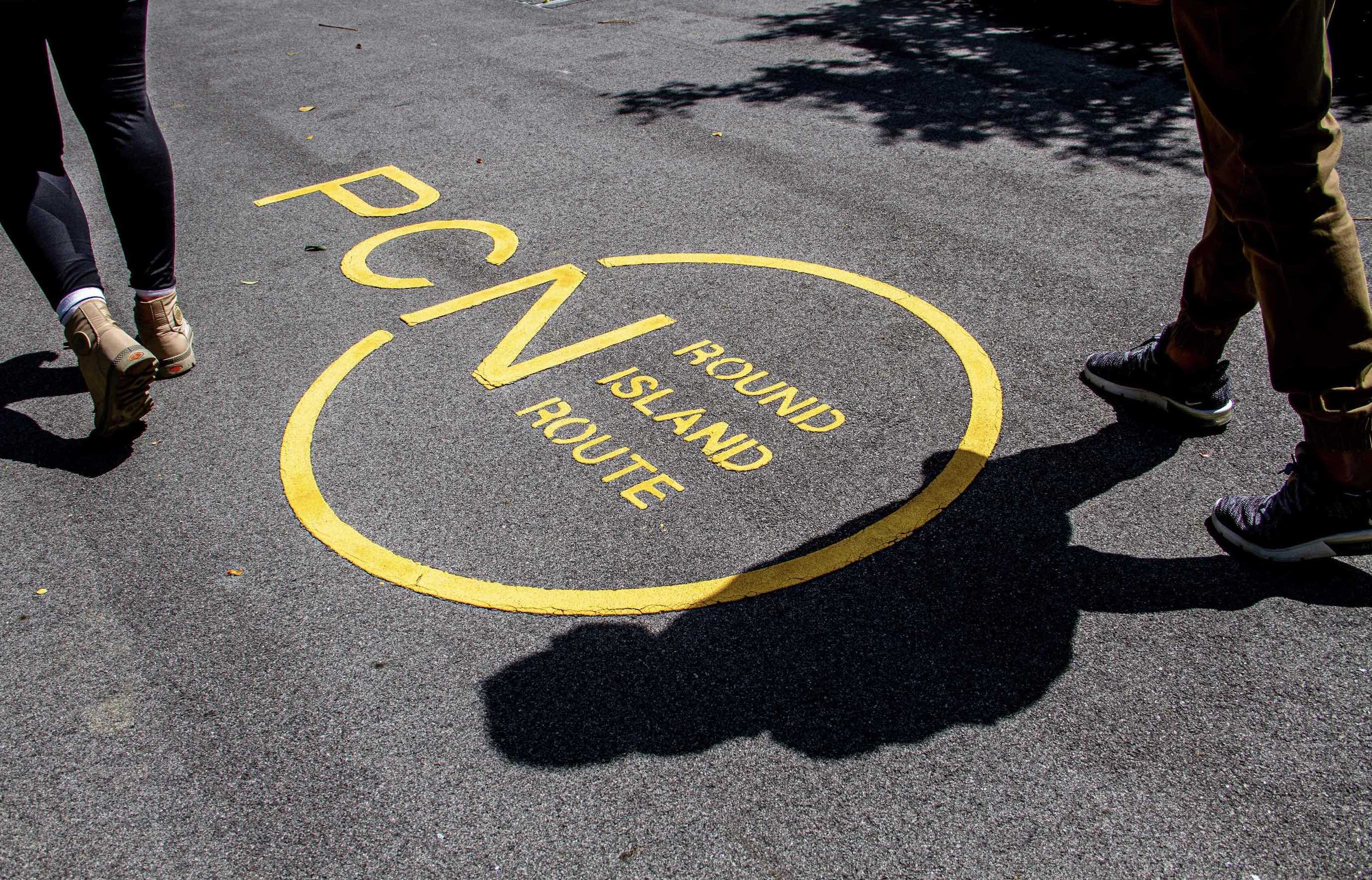
The Round Island Route (RIR), a continuous 150km park connector, is part of NParks’ overall plans to curate a 360km island-wide network of recreational routes comprising park connectors and trails.
When completed, the Round Island Route will be the longest recreational connection in this network. Besides providing more opportunities for nature-based recreation such as hiking and cycling, it will also help enhance ecological connectivity between natural habitats, thereby strengthening Singapore’s ecological resilience.
These all contribute to Singapore’s transformation into a City in Nature, a key pillar in the Singapore Green Plan, which is a national movement to advance sustainable development – to create a green, liveable and sustainable home for all Singaporeans.
Round Island Route – Phase 1
The first phase of the Round Island Route was launched on 22 January 2022. Stretching across 75km, it covers the eastern half of Singapore, from Rower’s Bay in the north-east, past the Singapore River to Berlayer Creek in the south. It also makes for the island’s longest recreational connection that encircles Singapore in the east.
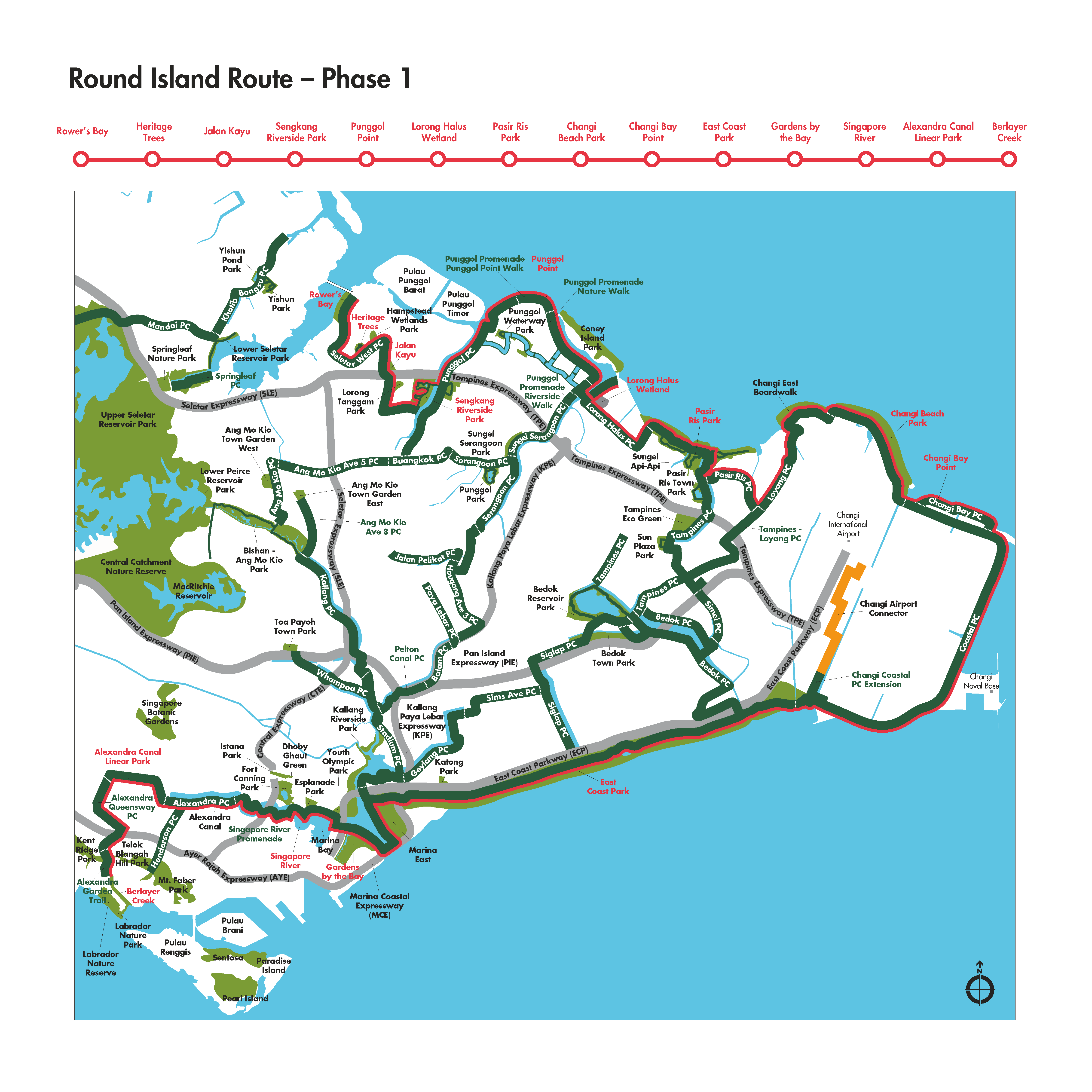 RIR overview with park connectors and nodes |
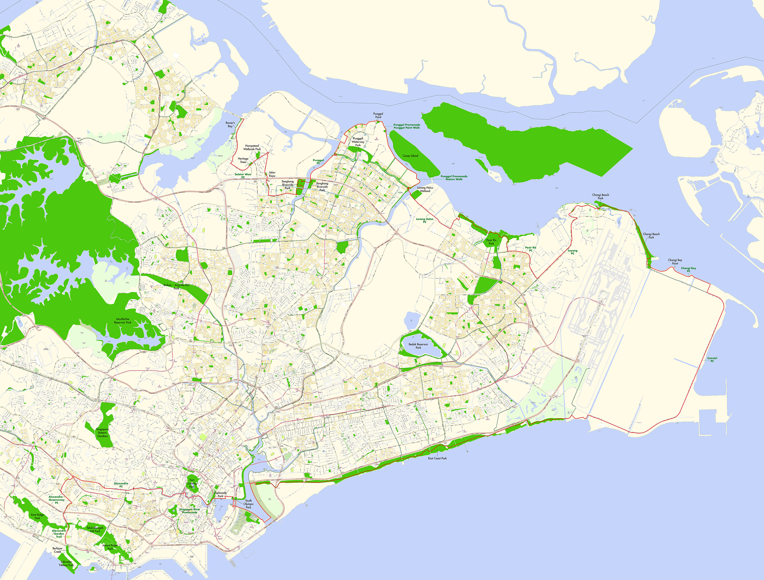 Map of the Round Island Route (Phase 1), including key elements |
Key parks along the route include Rowers’ Bay, Sengkang Riverside Park, Pasir Ris Park, Changi Beach Park and East Coast Park. Be it cycle or hike, hop onto any of these parks to start your journey along the RIR (car parking is available at the parks)!
Getting to the RIR
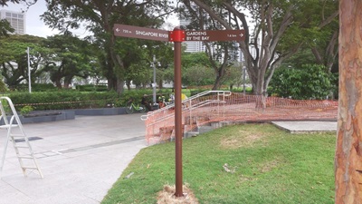
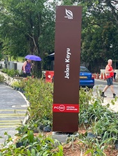
You can get on the RIR from any of the park connectors, or from the parks along the route! Keep a lookout for these RIR signposts. There are also shelters along the RIR nodes for you to take a break during your journey.
 |
 |
| Park/Connectivity Point | RIR Connectivity Point | |
|---|---|---|
| Rower’s Bay | Traffic junction nearest the trellis at Rower’s Bay. The RIR path is opposite Rower’s Bay. | |
| Sengkang Riverside Park | Exit of Sengkang Riverside Park near Sengkang West Way Sengkang Riverside Park Carpark |
|
| Pasir Ris Park | Toilet A2 | |
| Changi Beach Park | Pedestrian bridge at Changi Point coastal walk Changi Beach Park Carpark 7 |
|
| East Coast Park | Area H near Changi Coastal Walk Area A near Rhu Cross |
|
| Berlayer Creek | Junction of Alexandra Road and Telok Belangah Road |
New Features
Here’s some new features you will get to visit on this route:
Cycling bridges at Changi Bay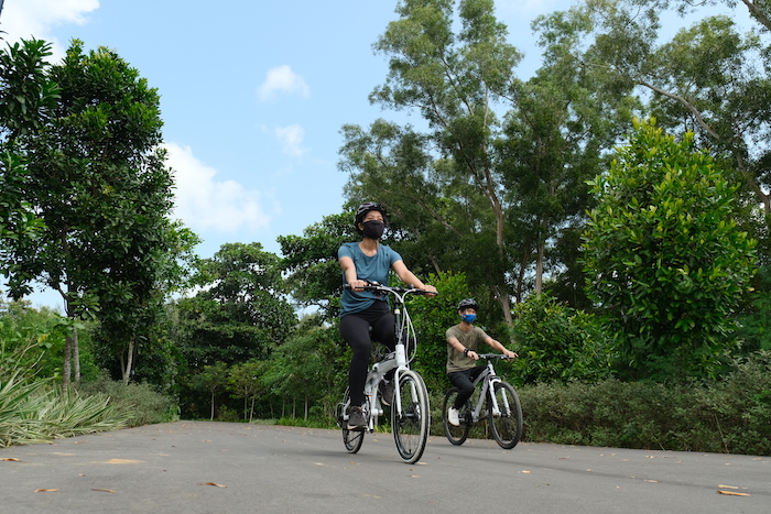 |
Totalling 140m long and made of slip-resistant glass fibre reinforced concrete, the two cycling bridges maintain the area’s rustic look while ensuring visitors’ safety. |
Boardwalk and lookout pavilion at Changi Bay 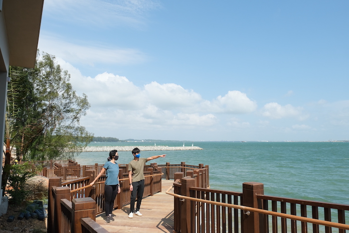 |
Get closer to the water’s edge when you visit the new boardwalk. Moreover, the pavilion offers visitors a sweeping vista of the waterfront, allowing you to soak in the tranquil scenery. |
Sengkang Riverside Bridge 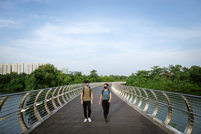 |
The largest bridge across a canal, it connects Sengkang Riverside Park on both banks of Sungei Punggol, enhancing accessibility for visitors and residents and also brings everyone closer to nature. |
Marine tiles 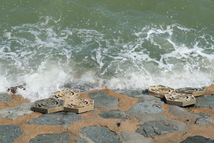 |
These concrete tiles are placed along the coast to provide habitats for marine life. Its combination of crevices, grooves and pits make for ideal niches for marine life, such as crabs, snails and starfish, providing microhabitats for marine biodiversity to thrive. |
Noteworthy Flora and Fauna Opportunities
On this Phase 1 Route Island Route journey, look around and see if you can find these living treasures!
Sepetir (Sindora wallichii) 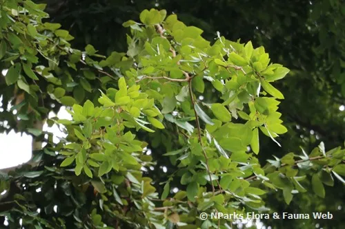 |
Native to Singapore, the critically endangered Sepetir can grow up to more than 30m tall with a massive crown. The wood is used to make furniture and in construction. This tree was propagated from the Sepetir Heritage Tree at Cranwell Road. |
Sea Beam (Maranthes corymbosa) 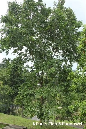 |
Growing up to 40m tall, the Sea Beam is a native tree that grows in coastal areas as well as primary and secondary forests. It produces pink and white flowers and green fleshy fruits. Its timber is used for the construction of houses and as posts. The species is classified as endangered in Singapore. It occurs locally in Pulau Ubin and Pulau Tekong. |
Penega Laut (Calophyllum inophyllum)  |
The Penega Laut is a native coastal tree that grows up to 30m tall. It has glossy oval-shaped leaves, sweet-scented white flowers, and round green fruits. Its fruits are usually dispersed by sea currents. There are also records of bats feeding on the fruits and dispersing the seeds.The species is classified as critically endangered and occurs locally in Pulau Seletar and Pulau Ubin. |
Small-Leaved Nutmeg (Knema globularia) 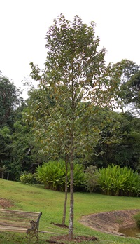 |
Growing up to 24m tall, the Small-Leaved Nutmeg is a native tree that can be found in lowland primary and degraded forests, as well as in coastal areas. These fruits are eaten by the Oriental Pied Hornbill (Anthracoceros albirostris). The species is classified as critically endangered in Singapore, and can be found locally in Changi, Lazarus Island, Pulau Pawai and Pulau Ubin. |
Seashore Mangosteen (Garcinia celebica) 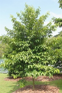 |
The Seashore Mangosteen is a native coastal tree that grows up to 30m. It has white flowers that occur in clusters of one to three and round fruits that turn bright rose-red when ripe and smell of apples. Its flowers are pollinated by insects and its fruits eaten by small mammals. |
Sea Lettuce (Scaevola taccada) 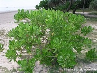 |
The Sea Lettuce is a common shrub or small tree that grows up to 10m tall. Its alternate, shortly stalked leaves have fleshy leaf blades that are mostly reverse egg-shaped. It grows along rocky and sandy beaches, on coastal cliffs and sandstone hills. Its flowers are pollinated by bees, and fruits are eaten by birds. It can be propagated by seed or stem cutting. |
White-Bellied Sea Eagle (Haliaeetus leucogaster) 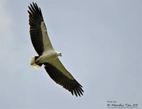 |
The White-Bellied Sea Eagle is the largest resident raptor in Singapore, with some adults attaining a wingspan of over 2m. It has a white head and underparts with greyish wings and a wedge-shaped tail. |
Brahminy Kite (Haliastur indus) 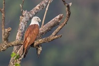 |
At about 45cm, the Brahminy Kite is a medium-sized raptor found throughout Southeast Asia. A common resident in Singapore, it can often be seen soaring over urban areas. These birds are particularly conspicuous around freshwater and coastal wetlands. They are not averse to consuming dead organisms and therefore play an important role as scavengers in these ecosystems. |
Fiddler crabs (Uca spp) 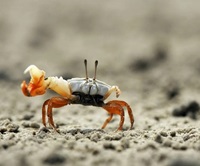 |
Fiddler crabs are common on our natural undisturbed shores, especially those near mangroves. They are often found in large numbers. The species is also highly sensitive to movement and will vanish when they feel footsteps on the sand or see shadows. |
Smooth-coated Otter (Lutrogale perspicillata)  |
The Smooth-coated Otter is usually spotted in pairs or in small families in our mangroves, mudflats, and other coastal areas. It is usually active during the day and night and feeds mainly on fish. |
Other useful information:
- Bicycles and Personal Mobility Devices (PMDs) are allowed on RIR tracks with the cyclist logo. Please be considerate and adhere to our Park Connector Network’s etiquette.
- Getting there: You can take go on the RIR from any of the parks and park connectors. Parking is available at parks such as Sengkang Riverside Park, Pasir Ris Park, Changi Beach Park and East Coast Park.

