
Island-wide Routes
Explore Singapore's island-wide walking and cycling routes, which link multiple park connectors and trails. Download the route map and look out for new colour-coded signs to help you navigate.
Last updated on 10 September 2026
We have curated several island-wide routes across Singapore comprising multiple park connectors and trails, which provide opportunities for you to explore outdoor spaces and walk or cycle in natural spaces for longer distances. These routes complement the Park Connector Network (PCN).
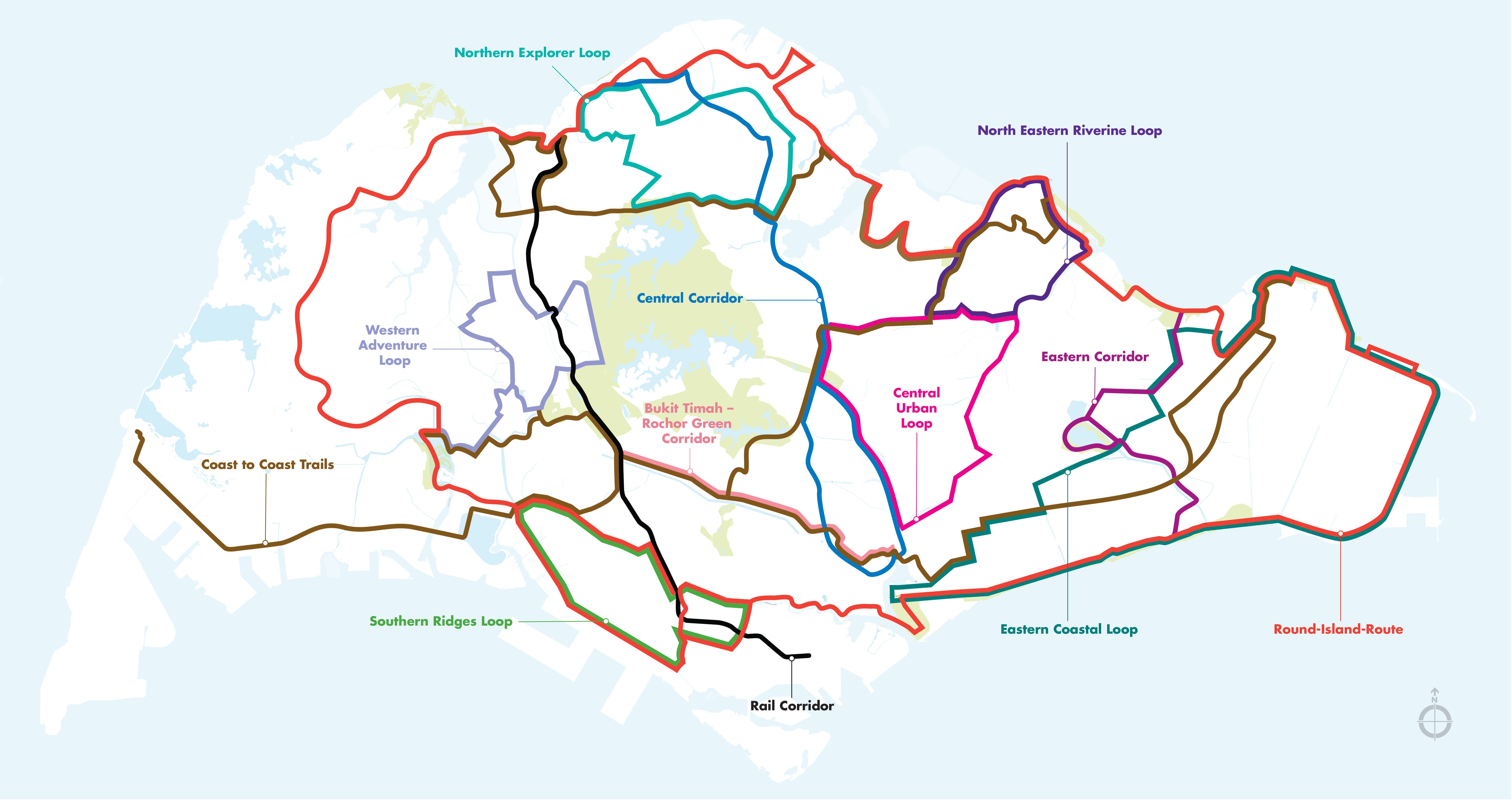
Map is subject to change.
Download the map here (opens in new tab).
NParks is introducig a colour banding system on PCN directional signage and lampposts to improve wayfinding, inform park users of their current route, and encourage them to explore different networks.
Proposed Colour Banding System
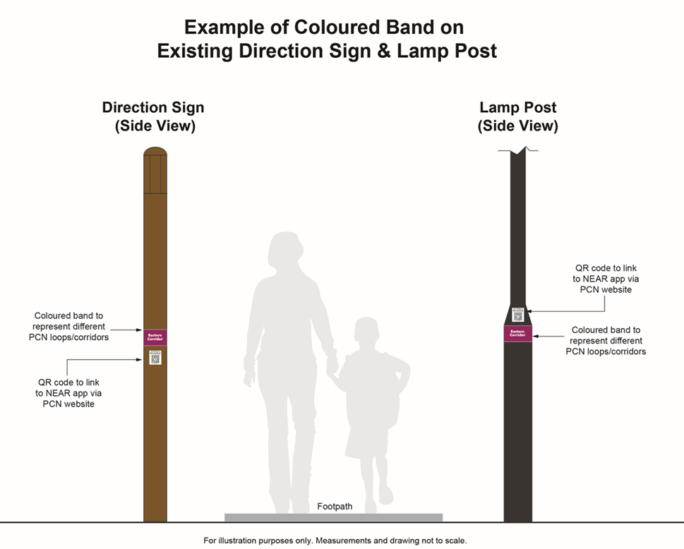
From November 2025 to February 2026, the colour banding system will be piloted along the Eastern Corridor.
Eastern Corridor Colour Banding Implementation Route
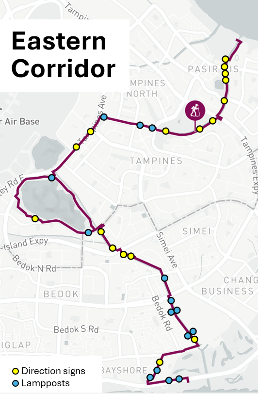
NParks will review the outcome of the pilot, including public feedback received, before progressively expanding the colour banding system across other PCN loops.